Listeners:
Top listeners:
-
 play_arrow
Revolution Radio Your home for the best variety of Christian music
-
 play_arrow
Heartland Newsfeed Radio Network Heartland Newsfeed Radio Network
-
play_arrow
Heartland Newsfeed Radio Network (Abovecast Backup) Heartland Newsfeed Radio Network
-
 play_arrow
Home For The Holidays Radio
-
 play_arrow
836 Van Morrison's Belfast; Roma in Europe; Classic European Hikes Rick Steves
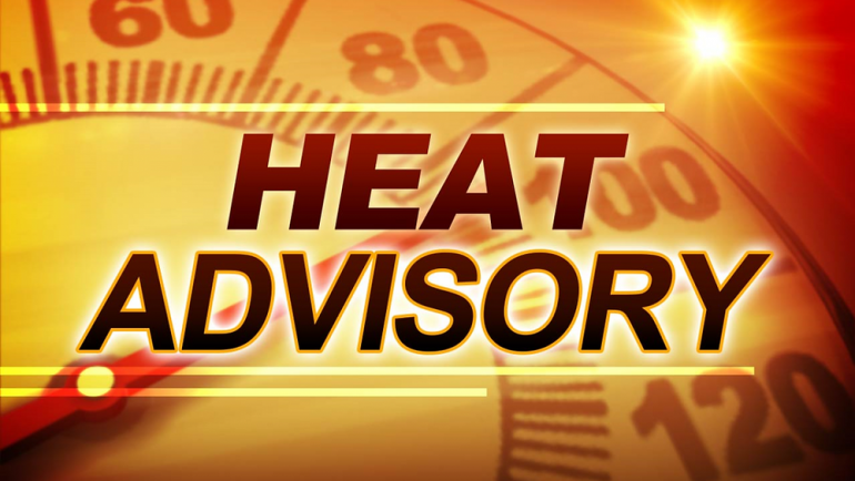
Bi-States to be impacted by pending severe weather
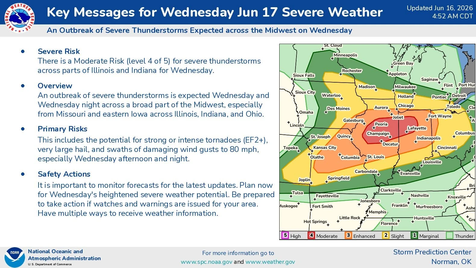
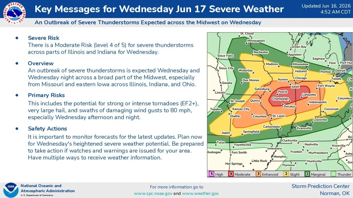
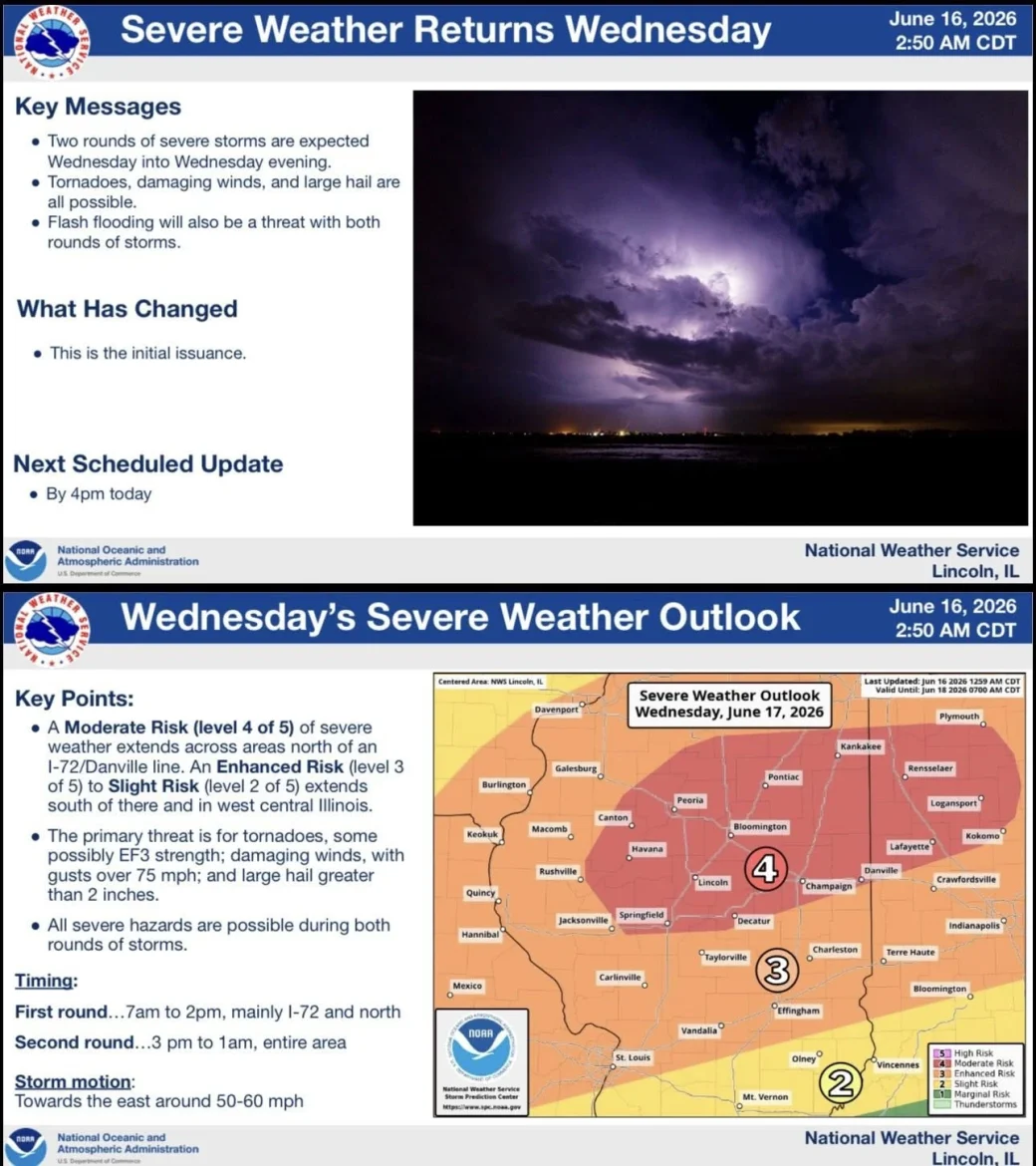
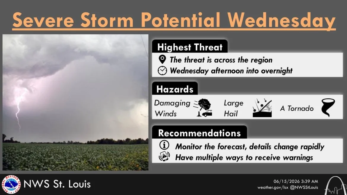
Another round of severe weather is in the forecast for Wednesday, beginning in the afternoon. The National Weather Service says there is a potential for strong winds, damaging hail, and even strong tornadoes.
The risk of this potential severe weather has been increasing since last weekend. Taylorville, Assumption, and Moweaqua are at a level 3 risk. In addition, Quincy, Northeastern Missouri, and most of the Greater St. Louis Metro Area fall under the Level 3 risk.
Meanwhile, Springfield, Lincoln, and Decatur would receive an upgrade to a 4 out of 5 risk on Tuesday.
Severe weather impact zones in the Bi-States
In Illinois, the National Weather Service also states that the highest risk for severe weather will be along and northwest of Interstate 70. The impact points in Missouri are roughly the same. However, the Level 3 zone ends just before the Kansas City metro area.
Residents in this area should stay weather aware and make sure that they prepare with a severe weather plan. Make sure your emergency kit includes a flashlight, batteries, a radio, phone chargers or portable power bank, and blankets. These should be in use in the event the storms get too severe and may have to evacuate.
Potential risks
The greatest potential risk of this storm system is large hail, heavy swaths of wind, and strong tornadoes.
The tornadoes could be as strong as an EF2 or EF3. Weather experts urge residents to stay alert and prepare to take precautionary actions.
There is also a possibility of rain-wrapped tornadoes. A rain-wrapped tornado occurs when heavy rain surrounds or completely hides a tornado, making it extremely difficult to see. Unlike traditional tornadoes that may be visible from a distance, a rain-wrapped tornado can approach without much warning. Therefore, it increases the danger for those who rely on visual confirmation.
These storms can produce the same destructive winds and damage as any other tornado. This includes downed trees, power lines, structural damage, and dangerous flying debris. Residents should never attempt to see or photograph a tornado. The best practice should be to take immediate shelter following the issuance of a tornado warning. This is especially the case, even if a funnel cloud is not visible.
Avoid driving through these storms whenever possible
Another safety concern would be driving during these storms. If you are driving when a tornado warning is issued, weather officials say the safest option is to avoid being on the road whenever possible and seek sturdy shelter before the storm arrives.
Should a tornado be nearby and you are unable to reach a safe building, do not try to outrun the storm. Also, don’t stop underneath a bridge or overpass, as those areas can become extremely dangerous due to high winds and flying debris.
If possible, pull over, park safely away from traffic, and get inside a sturdy building. If no shelter is available and you are caught in the immediate path of a tornado, experts recommend staying buckled inside your vehicle, keeping your head below the window line, and protecting yourself from debris.
Always remember, a vehicle offers little protection from a tornado, so the best safety measure is to plan and avoid driving during dangerous storms.

Jake Leonard, a broadcast media and journalism veteran, is the editor-in-chief of Heartland Newsfeed. Leonard is also GM and program director of Heartland Newsfeed Radio Network, wrestling editor and contributing writer for Ambush Sports, a contributing writer for My Sports Vote and Midwest Sports Network, and a former contributor to Bleacher Report and Overtime Heroics. He resides at home in Nokomis, Ill. with his dog Buster.


 68°F
Feels like 69°F°L: 68° H: 69°
68°F
Feels like 69°F°L: 68° H: 69°